Camino Photo of the Day: Slightly Lost in a Spooky Woods
After crossing the Pont des Pèlerins (Pilgrims’ Bridge), the Way climbed up to a forest road. I couldn’t find the trail markings in the dark, even with my flashlight. And these woods were definitely a little spooky. After wandering around a bit, I was soon joined by four pilgrims, two older German ladies and two younger French ladies. One of the younger French ladies had a GPS app mapped to the Camino. Once I had bandwidth later in the day, I downloaded the app. It would prove alternately helpful and frustrating in the days ahead.
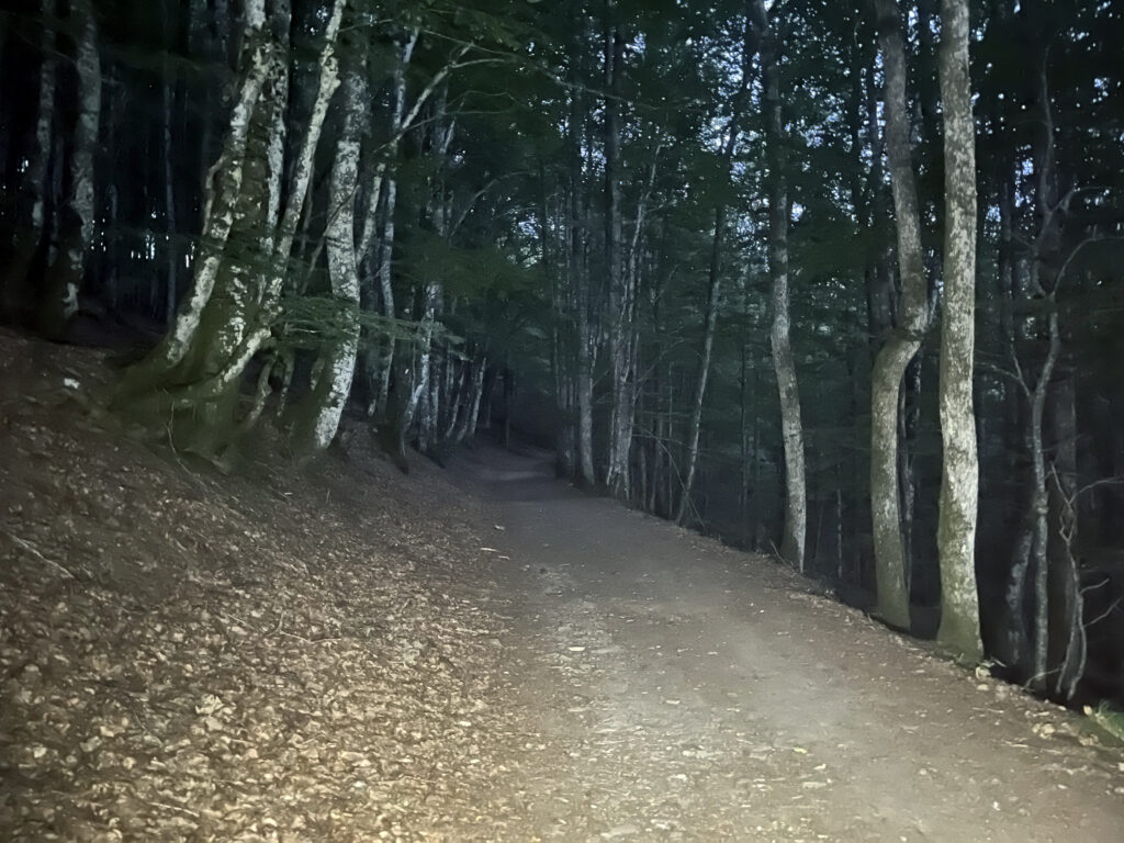
Date: 24 August 2023
Place: between Saint-Chély-d’Aubrac and Les Cambrassats, Aveyron Département, Region of Occitanie, France
Maps!
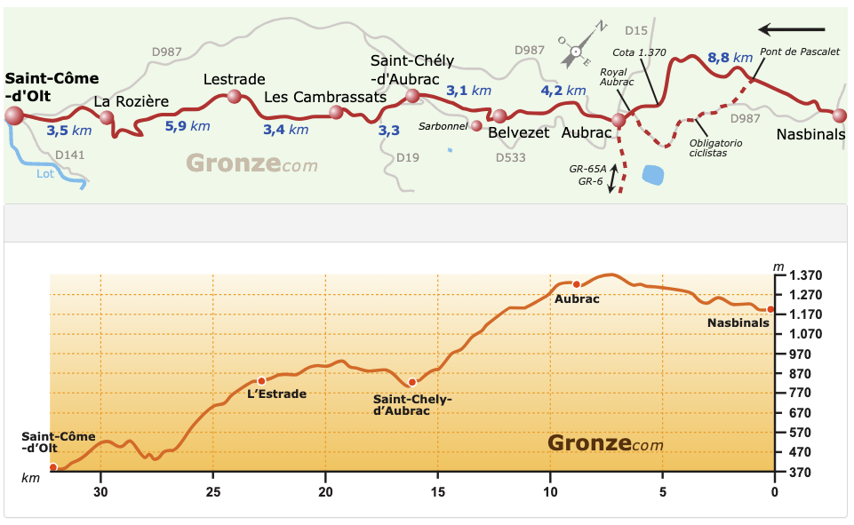
If you’re the sort who looks at the maps, you’ll note that the stage shown is 32+km long. I split this up into two days, since I wanted to spend some time exploring both Saint-Chély-d’Aubrac and Saint-Côme-d’Olt, both of which are on the list of most beautiful villages in France.