Camino Photo of the Day: From Mars
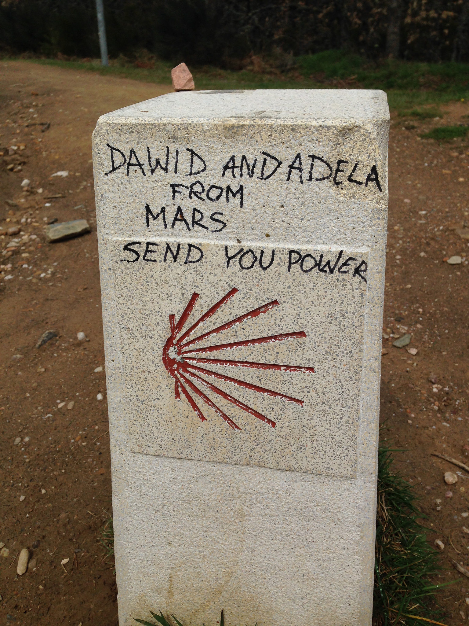
No explanation helpful or necessary. Date: 22 April 2016 Place: Between Manjarín and El Acebo de San Miguel (Castilla y León, Spain) Today’s map!
» Read moreWalking the Camino de Santiago
No explanation helpful or necessary. Date: 22 April 2016 Place: Between Manjarín and El Acebo de San Miguel (Castilla y León, Spain) Today’s map!
» Read more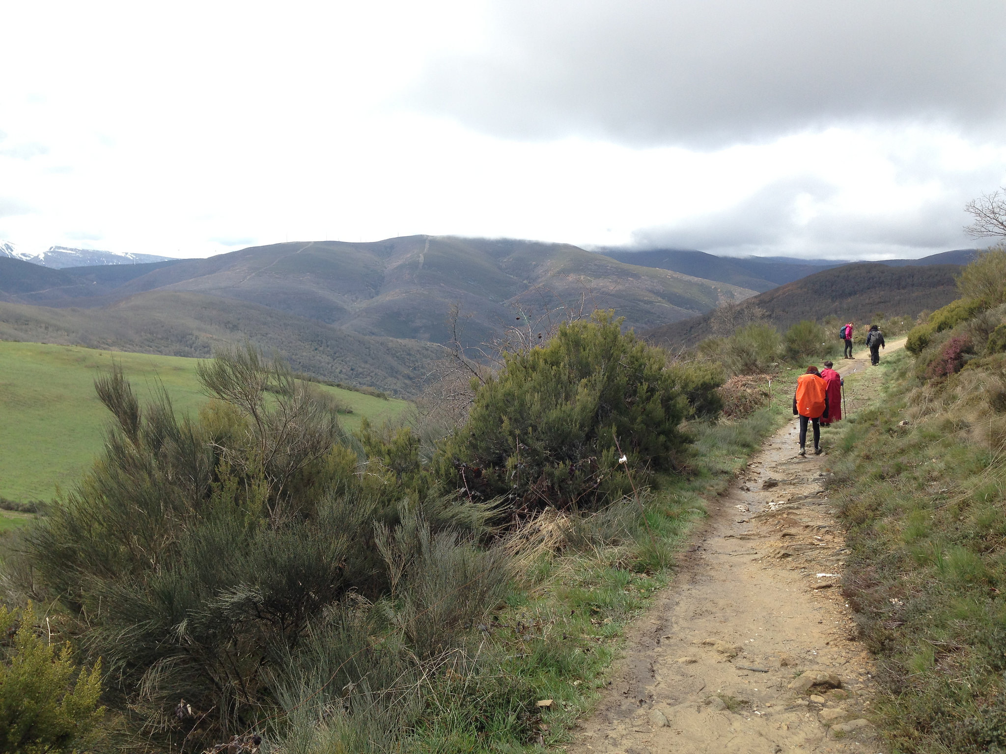
The Camino continues to wind through the foothills, giving us some spectacular views of the valleys below. On our 2013 Camino, this was the spot where I ran into a fellow who had walked the last 100 km of the Camino with his son, and then after arriving in Santiago took a train and taxi to Saint Jean Pied-de-Port and […]
» Read more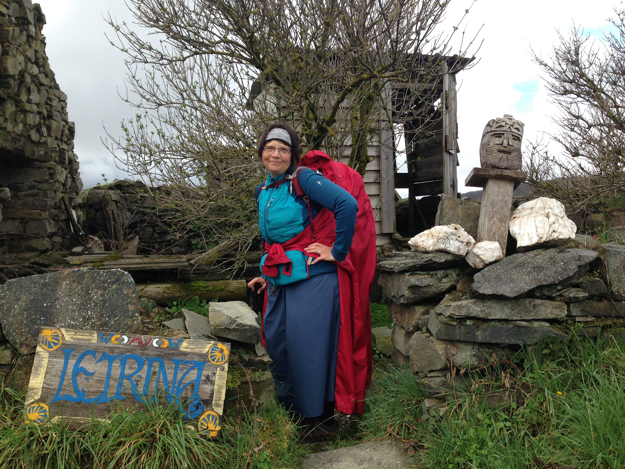
Francine has just spotted the only toilet in Manjarín, across the road from the albergue. Really, the less said about this, the better. Let’s just say that we’ll never be staying in the Refugio de Manjarín and leave it at that. Date: 22 April 2016 Place: Manjarín (Castilla y León, Spain) Today’s map!
» Read more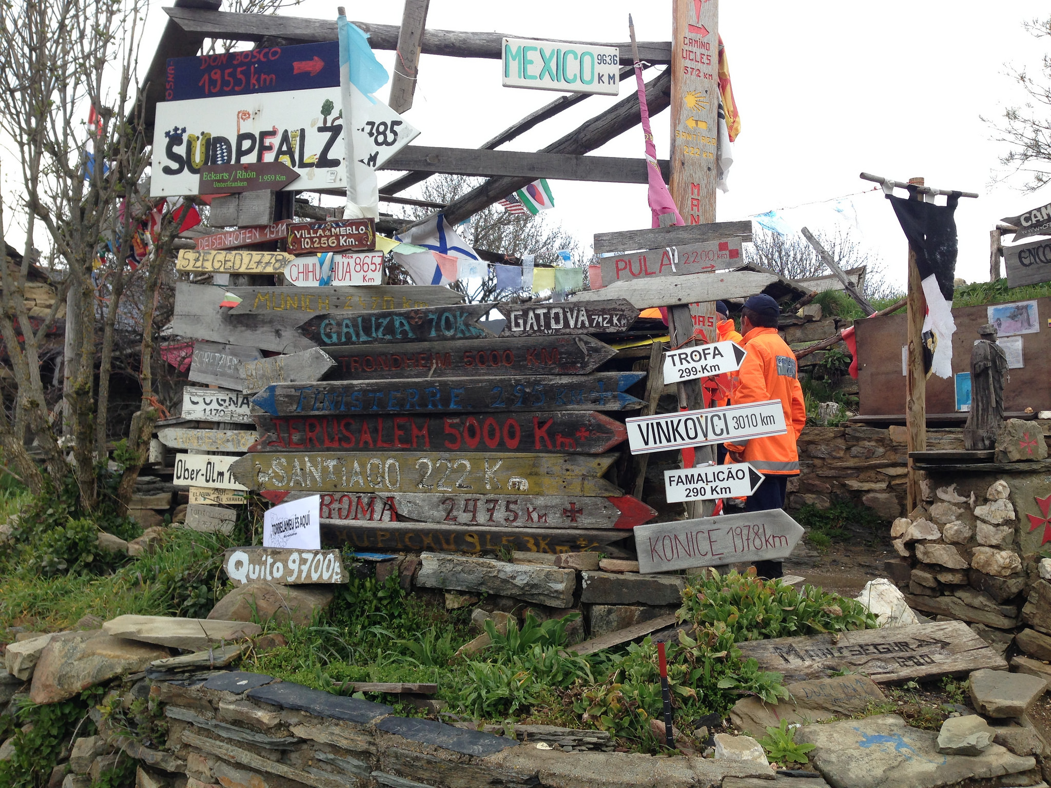
These signs may be found at the Refugio de Manjarín, described in the guidebooks as an albergue with “basic” facilities. And by basic, they mean that there aren’t really any facilities whatsoever. One person described it as “like a garden shed with no plumbing”. And the proprietor fancies himself as a member of the Knights Templar. You are far better […]
» Read more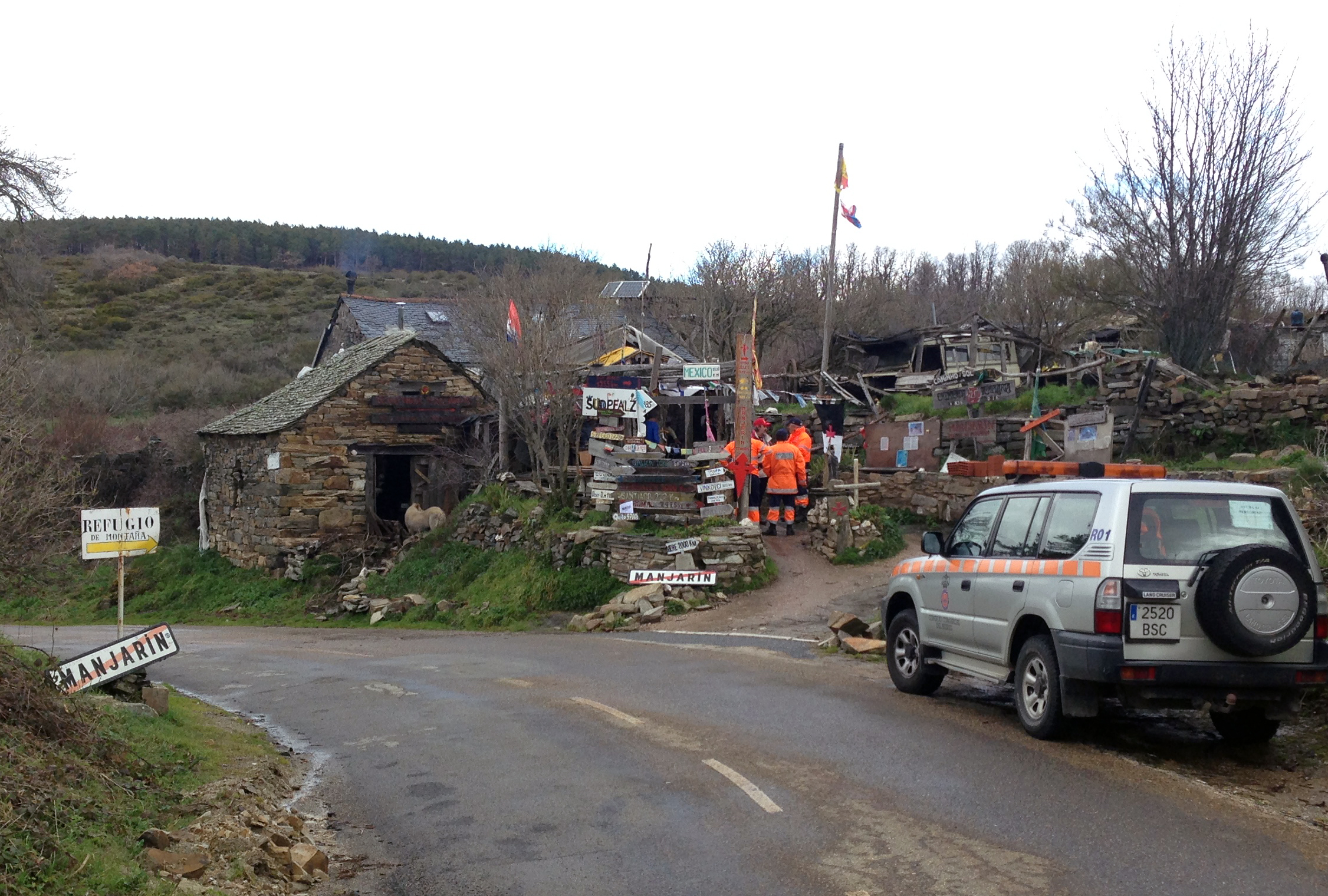
This is, more or less, the entire village of Manjarín. If Foncebadón was mostly in ruins, Manjarín takes that one step farther. This “building” is the only one still standing in the village. It is an eclectic albergue operated by hippies. The folks you see in the orange jackets are Guardia Civil, the Spanish national police force. Because of the […]
» Read more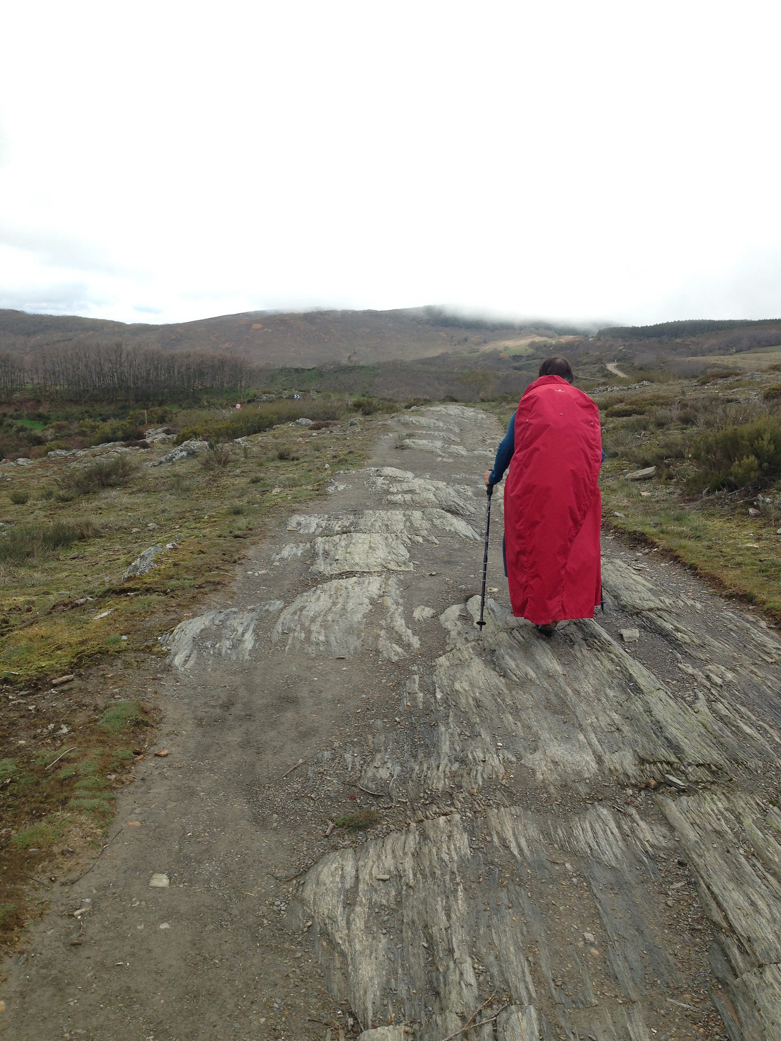
There are a number of places on the Camino where the path is treacherous, particularly when wet. Although this portion a little past Cruz de Ferro is rock – punishing on the feet – and it had been raining, at least it isn’t also downhill. That was still to come… Date: 22 April 2016 Place: Between Cruz de Ferro and […]
» Read more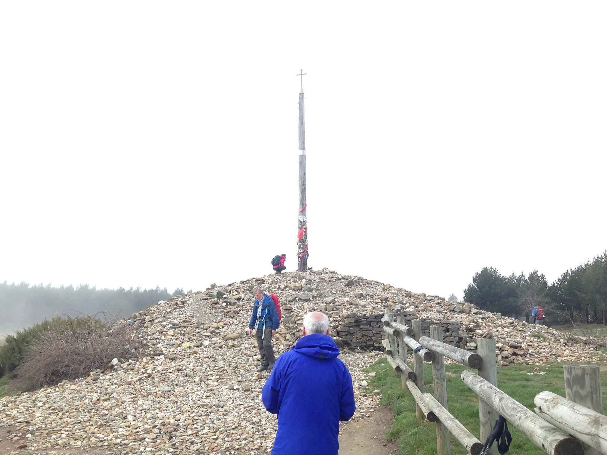
Having laid down our stones and prayed, Francine and I prepare to bid adieu to Cruz de Ferro. You can perhaps get an idea of the size of the pile of stones by the people around it. Every year, the local government hauls away as many as half the stones (and all the other detritus) to keep the mound manageable. […]
» Read more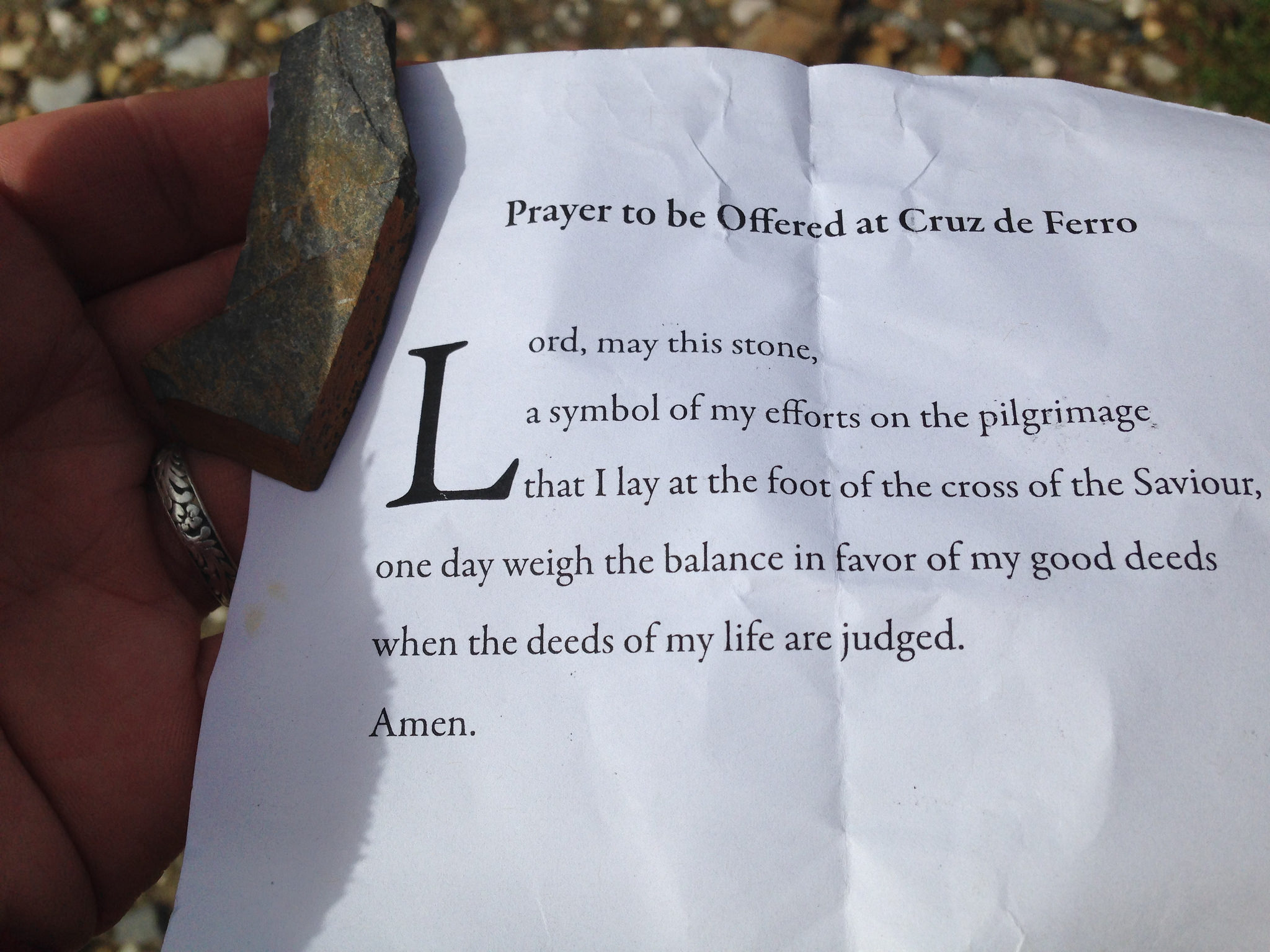
At Cruz de Ferro, the highest elevation on the Spanish Camino, there is an old tradition. Although I’ve heard several stories about how it got started in the Medieval era, I don’t know that any of them are true. You will have noticed in the previous photo, that surrounding the cross is a large pile of stones. Pilgrims have been […]
» Read more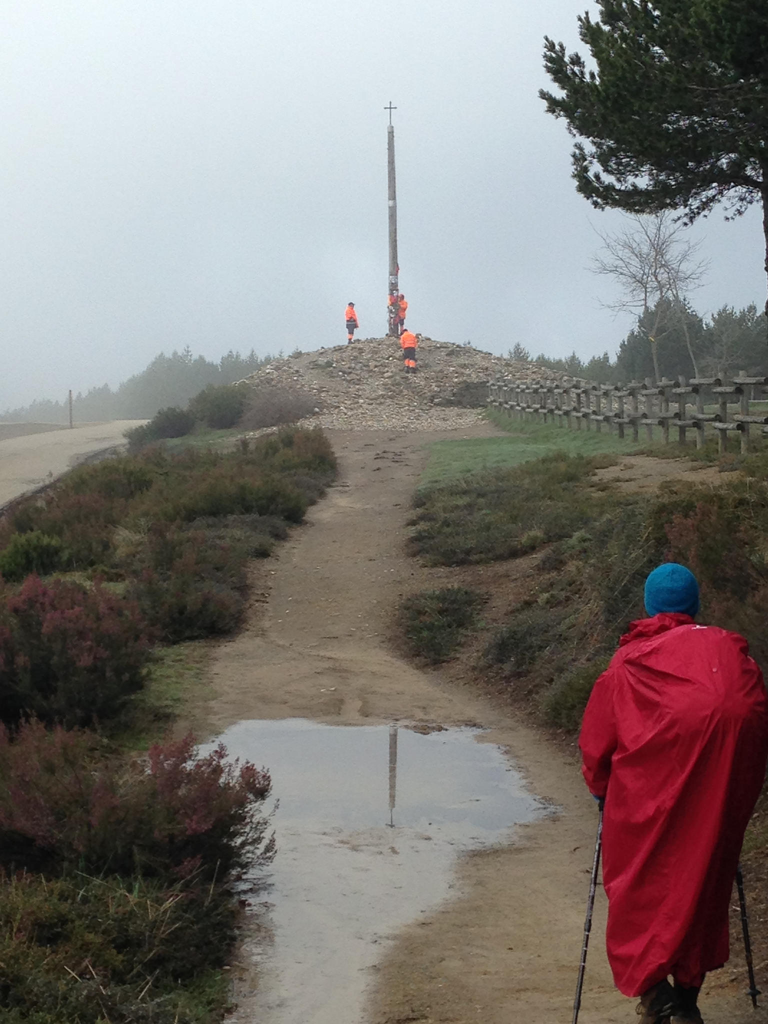
Through cloud and rain and mud we walked up the side of a mountain to the highest spot on the Spanish Camino. Thanks to the mist, we didn’t spot the Cruz de Ferro until we were practically on top of it. It may not look like much, but this is a place of particular importance for pilgrims. This, I will […]
» Read more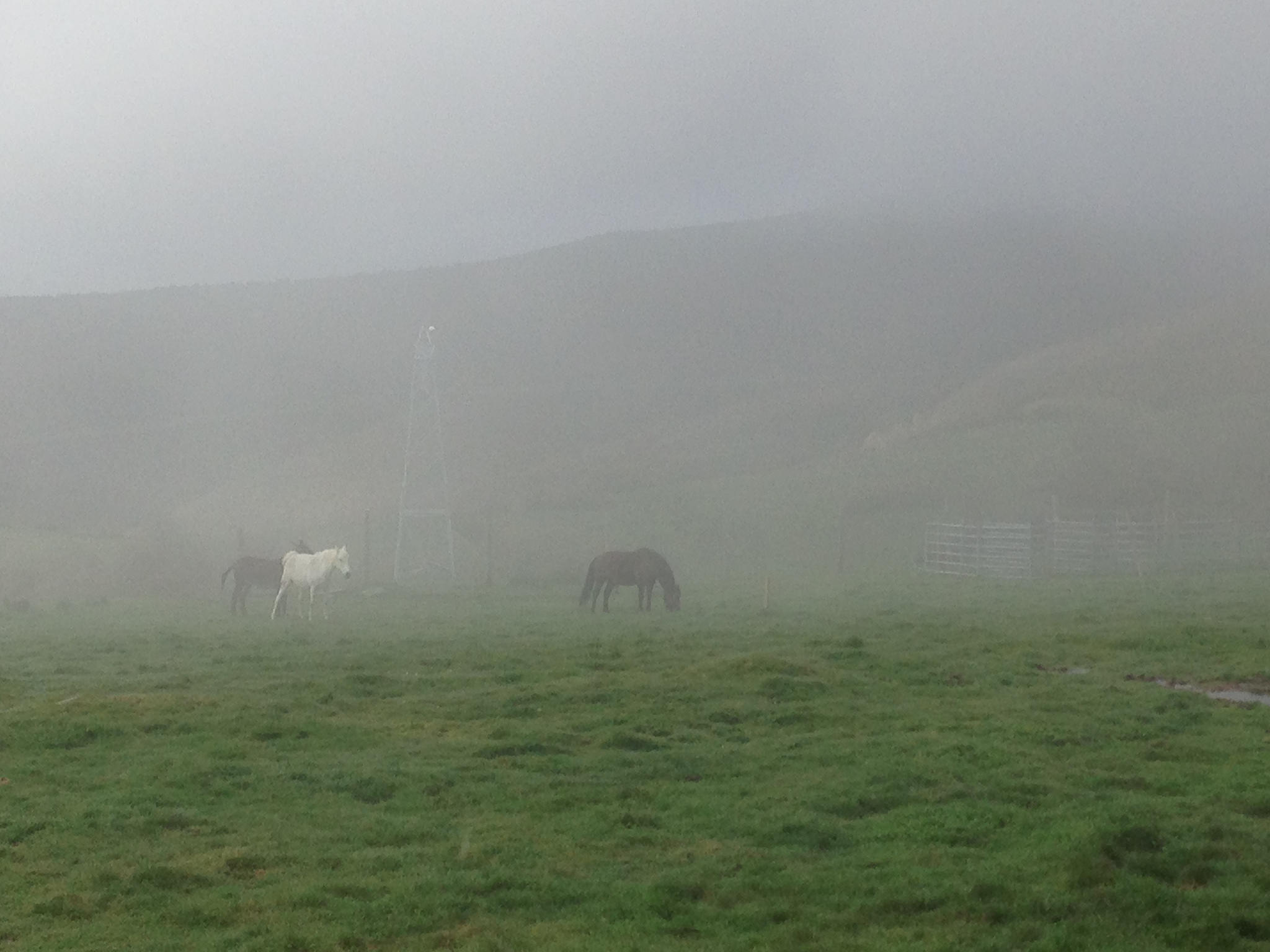
After Foncebadón, the Camino continues its upward trajectory into the hills, eventually peaking at the highest altitude on the Spanish Camino. We walked up into a cloud. These horses – practically pegasi, it seems to me – appear quite content in their misty home. This was two years ago today. Date: 22 April 2016 Place: Between Foncebadón and Cruz de […]
» Read more